Spiller’s Cove · Rockcut Trail
Spiller’s Cove Trail
A trail that feels like the island waking up — storm-light over sea stacks, Boreal Chickadees riding the wind, unpredictable swell, and cliffs that open into one of the most dramatic coves on the Rockcut.
Overview
Why this trail matters
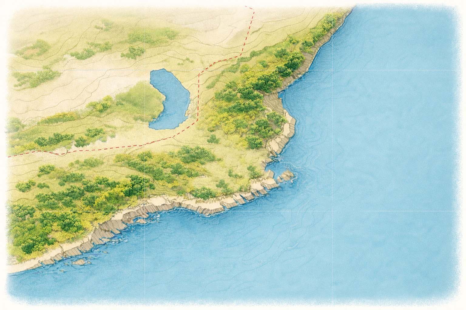
Spiller’s Cove is the signature “awakening” trail of the Rockcut. The geography
forces your senses open: clifftop exposure, sudden ocean drama, birds calling
ahead of weather, and the unmistakable silhouette of the Spiller’s Cove sea
stacks — the landmark everyone remembers.
Clifftop viewpoints
Storm-light photography
Sea stacks & seabirds
Gallery
Spiller’s Cove in frames
A few frames from the trail — the kind of views that slow you down whether
you planned to or not.
Randy’s field notes
“The trail is alive today. The birds are reacting before the weather changes —
a handful of Boreal Chickadees chattering ahead of the front. There’s a pressure
drop. Even the light feels tilted.”
Read more Rockcut posts in the Twillingate Facebook group: Rockcut field notes →
Read more Rockcut posts in the Twillingate Facebook group: Rockcut field notes →
Situational Awareness reports environmental relationships from known inputs (wind, aspect, cloud, visibility, precipitation). It does not provide advice, guarantees, or predictions.
Dot bars
●●●●●●●○○○
= 7/10
Higher dots
= stronger presence / influence
Lower dots
= weaker presence / influence
☀️ Sunrise / Sunset Potential
- Reflects: trail aspect vs solar direction, cloud structure (broken clouds favored), visibility, precipitation interference.
- Does not mean: a promise of color, spectacle, or outcome.
🌬 Wind Exposure
- Reflects: wind strength + direction relative to the trail’s aspect (offshore vs onshore).
- Higher dots: more direct wind energy on exposed faces.
🛡 Shelter
- Defined as: the inverse of Wind Exposure (no added assumptions).
- Higher dots: less direct wind energy.
Boundary: This is an instrument. Interpretation stays with the user.
This system is intentionally transparent. If any input is unavailable, it falls back without guessing.
1) Fixed geometry (static)
- Trail aspect (N, NE, E, …)
- Sun orientation (sunrise favors E/NE/SE, sunset favors W/NW/SW)
2) Live modifiers (dynamic)
- Wind speed + direction
- Cloud cover (%)
- Visibility (km)
- Precipitation (mm) + probability (%)
3) Weighting (first iteration)
- Sunrise/Sunset Potential: geometry is primary; sky structure and visibility adjust; precipitation reduces.
- Wind Exposure: strength tier sets baseline; onshore increases; offshore reduces.
- Shelter: inverse of Wind Exposure.
Note: This describes cause/effect alignment, not outcomes.
Keep this short and append-only. Users should be able to see what changed and why.
- v1 — Initial legend + transparent weighting disclosure.
- v1.1 — (reserved) If weighting changes, record old → new and rationale.
Practice: Recalibration is logged; prior logic is not erased.